Chesapeake Bay Benthic Monitoring Program

 Home •  Methods and Results •  What Are Benthos? •   History  •  Reports and Other Documents •  Data Sets •  Related Information 
_____________________________________________________/\__________________________________________________________________


History

Before July 1984

Prior to 1984, benthic studies were conducted to assess the effects of power plant operations on benthic communities.  The macrobenthos of the Calvert Cliffs region of the Chesapeake Bay were sampled four times annually between 1971 and 1977, and seven to ten times annually between 1977 and 1980.  Macrobenthic abundance, biomass of dominant taxa, and size frequency of dominant bivalves were measured.

Periods

From July 1980 to June 1984, 33 stations were sampled ten times each year.  The distribution of sampling stations encompassed a large portion of the mesohaline zone within the mainstem of the Bay and the Potomac River estuary.  Sampling efforts were particularly intensive near the Calvert Cliffs and Morgantown Steam Electric Plants.

July 1984-June 1989

The Maryland Chesapeake Bay Long-Term Benthic Monitoring Program began monitoring benthic community health bay-wide in 1984.  In the first five years of the program, 70 fixed stations were sampled eight to ten times per year.  On each visit, three benthic samples were collected at each station and processed.

July 1989-June 1994

In the second five years of the program, fixed site sampling was continued at 29 stations, and a stratified random sampling element was added.  Samples were collected at random from approximately 25 km2 small areas surrounding these stations to assess the representativeness of the fixed locations.  In addition, four new areas were established in regions of the Bay targeted for management actions to abate pollution: the Patuxent River, Choptank River, and two areas in Baltimore Harbor.  Each area was sampled four to six times each year.

July 1994-Present

Since 1994, the Chesapeake Bay Benthic Monitoring Program has consisted of two elements: a fixed-site monitoring sampling effort directed at identifying trends in benthic condition, and a probability-based sampling effort intended to estimate the area of the Maryland Chesapeake Bay with benthic communities meeting and failing to meet the Chesapeake Bay Program’s Benthic Community Restoration Goals.

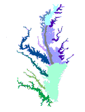
Click on the figure of the Bay to see the detailed Baywide Stratum Map.

The fixed-site monitoring sampling effort collects three replicate samples in spring and summer at a current suite of 27 stations.  The probability-based sampling effort allocates samples equally among six strata.  Different probability sample allocations were used in 1994 than in later years.  In 1994, the design was intended to estimate impaired area for the Maryland mainstem (including Tangier and Pocomoke Sounds) and for the Potomac River, while in later years the design targeted five sub-regions in addition to the Potomac.  Twenty-five random sites (one sample per site) are allocated annually to each stratum.  A fresh set of sampling sites is selected each year.  Regions of the Maryland mainstem deeper than 12m are not included in the sampling strata because these areas are subjected to summer anoxia and have consistently been found to be azoic.

A similar stratification scheme has been used by the Commonwealth of Virginia since 1996, permitting annual estimates for the extent of area meeting Restoration Goals for the entire Chesapeake Bay.


CIMS
Home
Methods and
Monitoring
Results
What are
Benthos?
History Reports and
Other Documents
Data
Sets
Related
Information
LTB
Home
Credits

URL http://esm.versar.com/vcb/benthos/history.htm

Revised: December 2, 2003.